My how times have changed and mainly due to the Covid 19 virus that has interfered with all our lives. For Cath and I, it has disrupted our hard earned plans to travel the globe each year while our age and health allows us. We have always felt a kind of urgency, to see what we could discover and learn what the world and it's people had to offer. For now we have had to be content with travelling locally but hope is finally beginning to show itself after almost 18 months.
This year we decided to feed the travel bug with a 3600 km trip from the NSW South Coast to Brisbane QLD, visiting several lovely towns on the way and on our return trip and over 2 weeks. It was also a great opportunity to give our new car a run.
Mollymook to Brisbane Map
Our first day's travel, saw us leave home and head straight for the small hamlet of Karuah, bypassing Sydney all together.
Karuah has been passed by the motorway, like so many other small towns, but worth the visit.
We stayed at the
Riverside Motel which was immaculately presented and worth the stay.
After unloading our bags, it was time for a walk around this pretty riverside village.
The Karuah Bridge crosses the Karuah River amazingly enough.
There are some beautiful homes along the river.
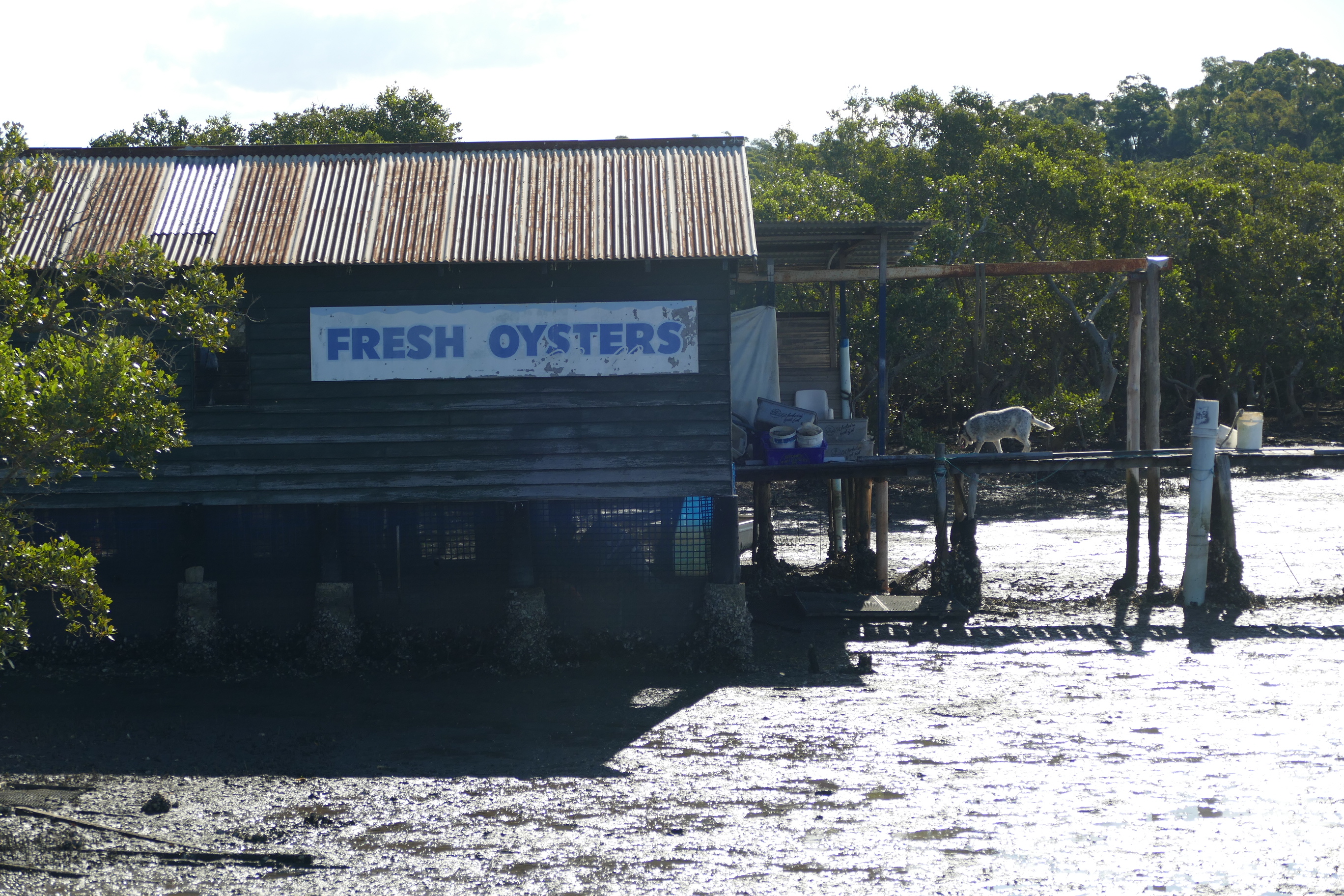
Karuah has a healthy oyster industry.
Flat bottomed oyster punts are everywhere here.
Huge fresh oysters were everywhere to be found and it just so happened that I had brought my oyster shucking knife along. How unexpected !
Now lets cross that bridge, but not until we get to it. 😄
The view from the northern side, looking back toward town.
Gotta love these sleepy little places.
Here, you can see some of the many oyster leases in the area.
The Karuah River divides the Port Stephens and Great Lakes Shires.
More of that tranquil perfection.
A couple of oyster processing sheds a little closer up.
This old timber oyster punt seems to have been kept for prosperity.
We enjoyed the walk in the warm winter sun.
These guys returning with the day's harvest.
This yacht isn't going anywhere in a hurry.
This jetty also doubles up as a secure salt water bathing area for the locals.
Before dinner, I decide to head back out for a few sunset pics.
The next morning, we bid goodbye to Karuah and headed to Forster to visit family.
This trip was also about celebrating both our birthdays and it was nice to be taken out for lunch as a treat.
Before lunch, we took a walk with Cathy's sister, along the inlet.
Forster Tuncurry's Marine Rescue returning after a morning's exercise.
Their smaller vessel at dock.
And the base, standing proudly nearby.
A couple of locals enjoying their surrounds.
The inlet seemed to be popular with the fisho's.
The pelicans know who their mates are.
And the winner is .......
After visiting family, it was time to drive on to Urunga, just south of Coffs Harbour, for the night.
We stayed at the
Ocean View Hotel as we have done in the past on various bike trips. It was getting late and was raining this afternoon, so we stayed in, enjoyed a few quiet drinks and had a lovely pub meal. Tomorrow was another day.
The next morning, we woke up to better weather, so we spent some time on
Urunga's board walk before heading further north.
Cathy waits for no one. Not even her loving husband. 😇
This is what remains of the original board walk.
It's amazing the things you see when you simply slow down a little.
Here, the boardwalk branches off into the mangroves.
It was entertaining to watch this fella stalk small fish.
The sun was finally breaking through the cloud.
A little history on dredging the inlet.
The board walk takes you all the way out to the surf.
Looking back toward the township.
That glorious sunrise.
Oh, she has returned.
On the way back, I notice this sting ray in the shallows.
Leaving Urunga, we headed inland through Nimbin, passing
Nimbin Rocks, on our way to Tweed Heads to visit family.
Formed when the nearby Mt Warning eropted 20 million years ago.
They look eerie amongst the low lying cloud.
Arriving in
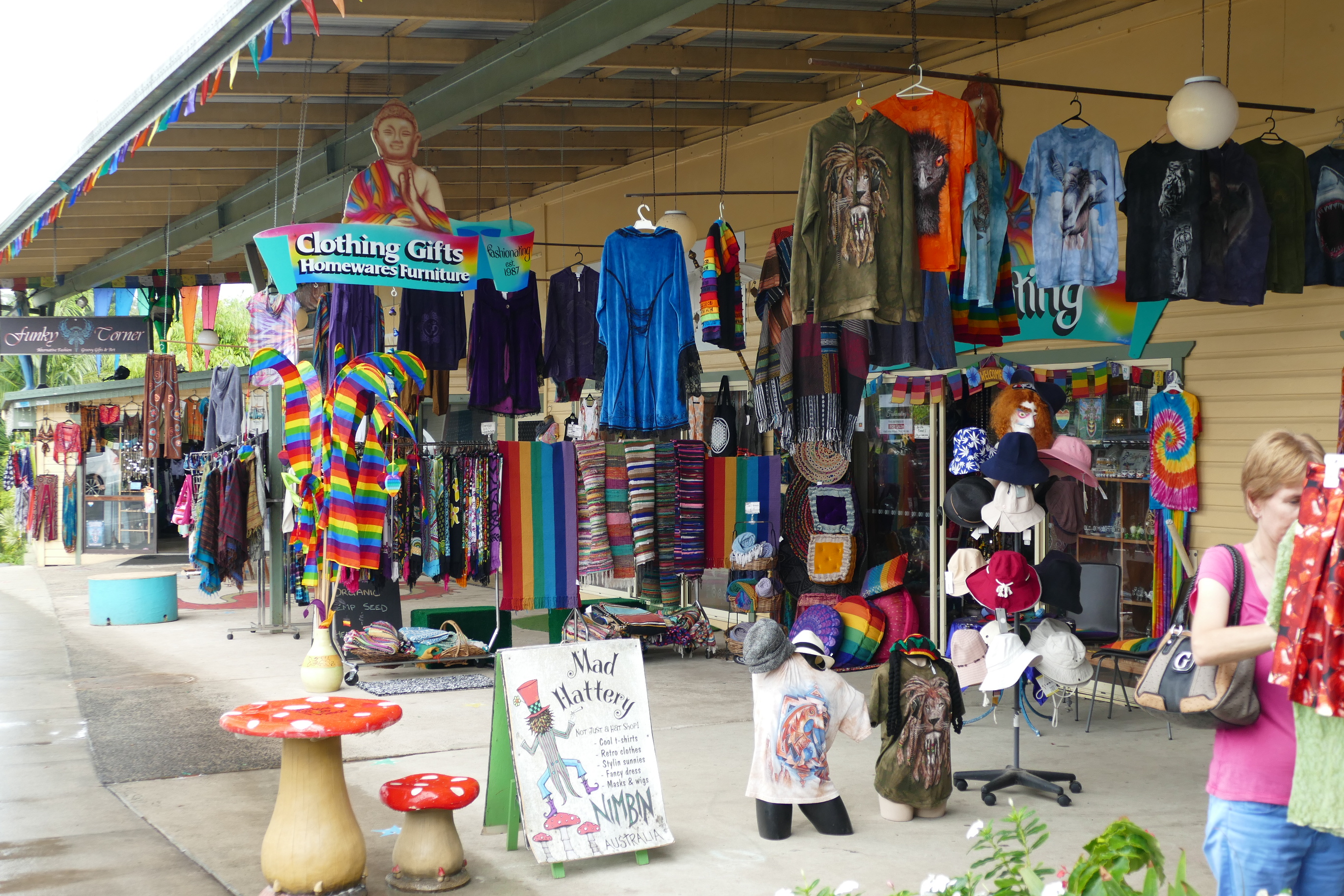
Nimbin, we are greeted with colourful shop fronts and some of the strangest people youll ever meet.
The weather wasn't perfect, but we made the most of the time we had to take a look around.
This sign kind of sums the town up.
Marijuana references just about everywhere you look.
And alternative clothing stores.
A few stone carvings about the place. We thought this one was one of the better.
Leaving Nimbin, we made our way for a 2 night stay with Cathy's brother and partner in Tweed Heads, where we spent the evening catching up and sharing a meal together.
The next morning, the weather had improved dramatically and were greeted with beautiful winter sunshine, so it was off to
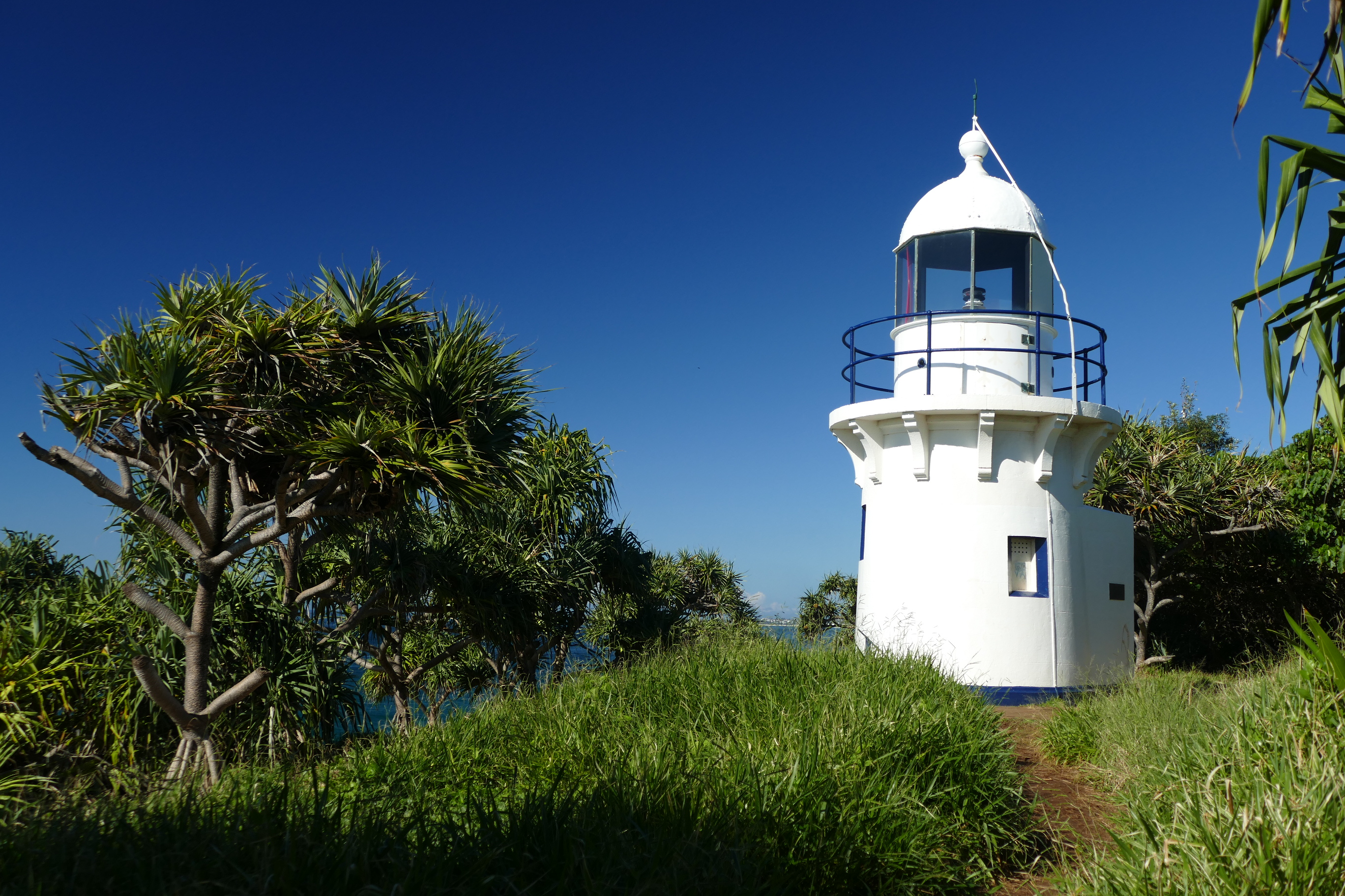
Fingal Head for look see.
The short walk from the car park was pleasant.
And here she is. Not a very tall lighthouse, but effective atop the cliff edge.
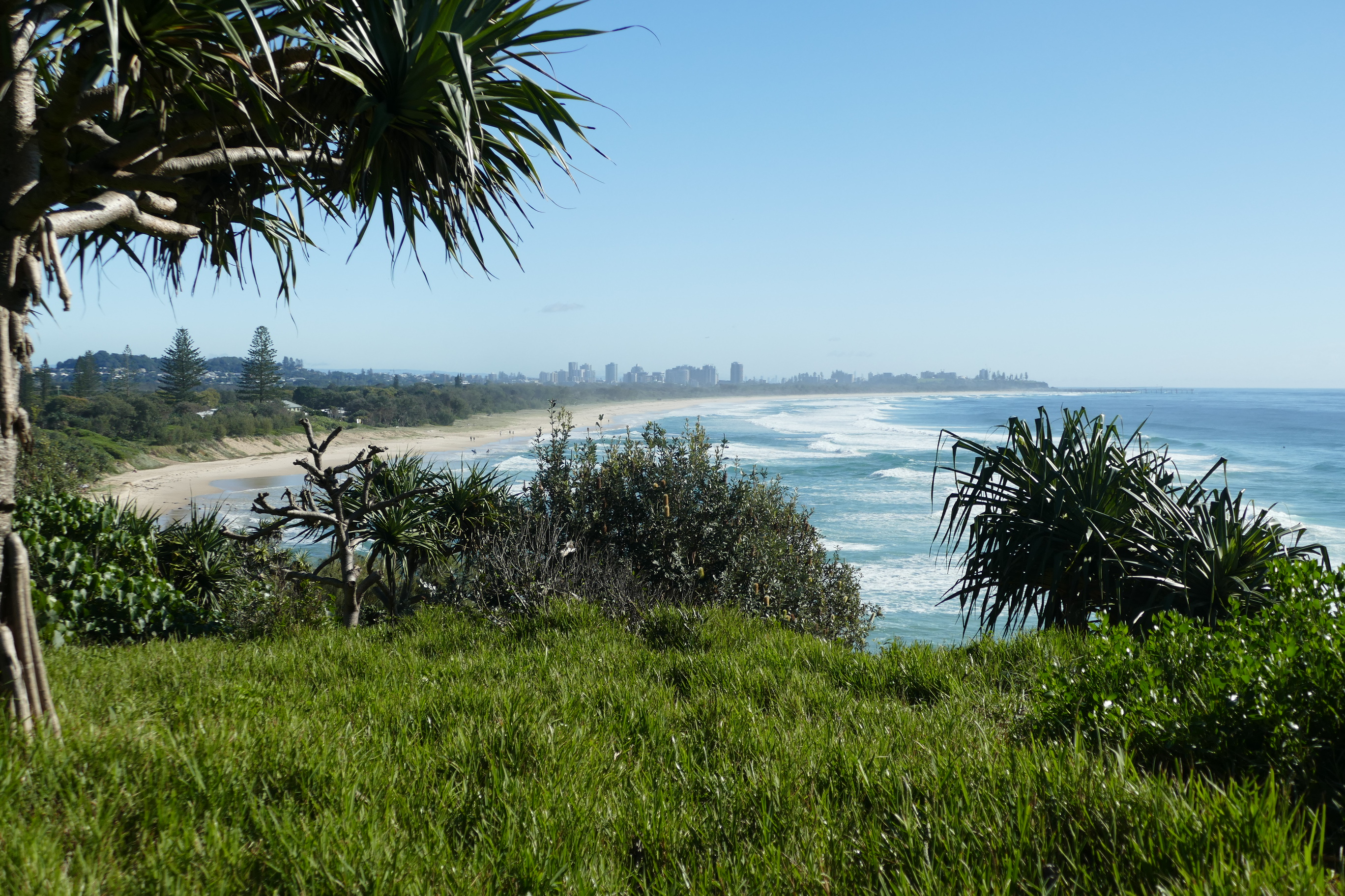
The view through to Coolangatta across the border in Queensland.
That's Cook Island just 600m off shore.
Cook Island is now an aquatic reserve.
These rock formations are not unlike those found at the Giant's Causeway in Northern Ireland.
The coastline is quite dramatic, especially with a large swell to make things interesting.
A walk further south reveals a lovely beach.
Making our way back around to the lighthouse.
Close up.
After a pleasant morning, we stopped by this cafe for a break.
Clever use of an old tipper in the garden, I thought.
After lunch, we took a drive inland and into the mountains, across the border into Queensland.
Look the opposite direction into NSW.
Still at the border, we take advantage of the spectacular views over the Tweed Valley.
But we were off to visit Natural Bridge and Springbrook.
Loving our new Tucson.
Another pleasant forest walk to visit Natural Bridge.
Some of the trees were enormous, but this was a strangler fig with not much left of the original tree at all.
The temperature dropped the further we walked to the bottom of the valley.
The rainforest down here was stunning to see.
A short timber bridge to cross to the stream.
Formed by constantly flowing water from above, eroding the rock formation over time.
The sunlight shining through the top, made for a great photo.
Moving around from another angle.
Walking a little further into the cave under the stream.
Looking out to where we walked from.
Walking around to the top of the cave, we find the cause of the strange formation.
Cathy loves these walks.
It’s amazing to see such beautiful, large Staghorn ferns growling high in the forest canopy.
Leaving Natural Bridge, we move on to see the
Best of all Lookout.
And off we go.
And the views were incredible.
Looking over the Tweed Valley from a different angle.
Some useful information if you can be bothered to read it.
Somewhere to sit and admire the tranquility and stunning scenery.
The track back to the car park.
The next morning we leave Tweed Heads and Cathy’s Brother and partner, to head for Brisbane but catching some visits along the way.
First stop is
Hinze Dam, not far from the area we visited the evening before.
A lot of work has been done to beautify the place to make it a worth while attraction.
Part of the dam wall and spill way.
It was a stunning day.
Cathy’s itching for a walk. I just know it.
The dam wall keeps on going forever. We walked 20 mins one way before giving up and turning around.
Looking down the spillway from above.
The spillway from the bottom carpark.
I thought that inspection point was interesting. Don't know if I'd feel comfortable in there though.
Yet another spectacular forest walk.
These strangler figs really can grow huge.
We met this little local.
And at the bottom of the valley, another beautiful water fall.
A little rain keeps these looking great.
Some great scenery but pics do not capture the smell of the rain forest.
The worst part about walking down into valleys is climbing back up and out again.
Eventually we arrive at my Uncle and Aunt's home in Western Brisbane and we had a lot of catching up and chatting to do. My Aunt had a very inviting meal cooked for us that evening and we discussed some ideas to spend the next day.
So we decided to explore Brisbane City from the water, catching the River Cat in the morning.
For a very low price, you can get on and off these things as often as you like, for the day.
It's always pleasant being on the water in such perfect weather.
Approaching the Story Bridge.
Australia's longest cantilever bridge, opened in 1940.
Just around the river bend, Brisbane's concrete jungle, typical of major cities around the world unfortunately.
Our first stop. Riverside. Not unlike Sydney's Darling Harbour, with it's numerous cafes and restaurants.
A 10 minute walk up from Riverside is the Botanical Garden.
Quite a pleasant place to explore. It's interesting to see how it differs from Sydney's Botanical Garden, due to the warmer Queensland climate.
The weather was certainly a treat today, even though it was winter.
These show boats would be a treat to cruise on as a lunch or dinner venue.
The wall gardens added colour to an otherwise drab concrete wall.
Apart from the larger River Cat, Brisbane also runs these smaller Kitty Cats that run commuters across the river at different points.
Cathy and I had a great day in the City but we were really looking forward to meeting up with my lovely triplet cousins in the evening. It's been so long since we've all been together in one room.
It would have to be about 40 years since we were able to do this together, but it was so worth the wait.
And one with Cathy and the girls.
Brisbane to Mollymook Map On our return trip home, we planned to visit Lightening Ridge for a couple of nights, however, the whole placed was booked solid due to the Variety Bash taking over the whole town. Although it was a bummer that we couldn't visit, we simply changed our trip home to return along the coast then through the Hunter Valley.
First stop from Brisbane was the very nice town of
Goondiwindi. Tonight's accommodation was prebooked and paid for, so we stood to lose the cost of the stay if we didn't stay. As always, we walked the town in the afternoon after we unpacked the car.
I always find these distance signs amusing.
We didn't expect much from Goondiwindi, but we were pleasantly surprised to find it such a clean, peaceful town. One of the best we've visited actually.
The
Pioneer Motel is where we stayed at and we highly recommend it.
The next morning, we braved the cold to take another look around before getting back in the car and resuming our drive.
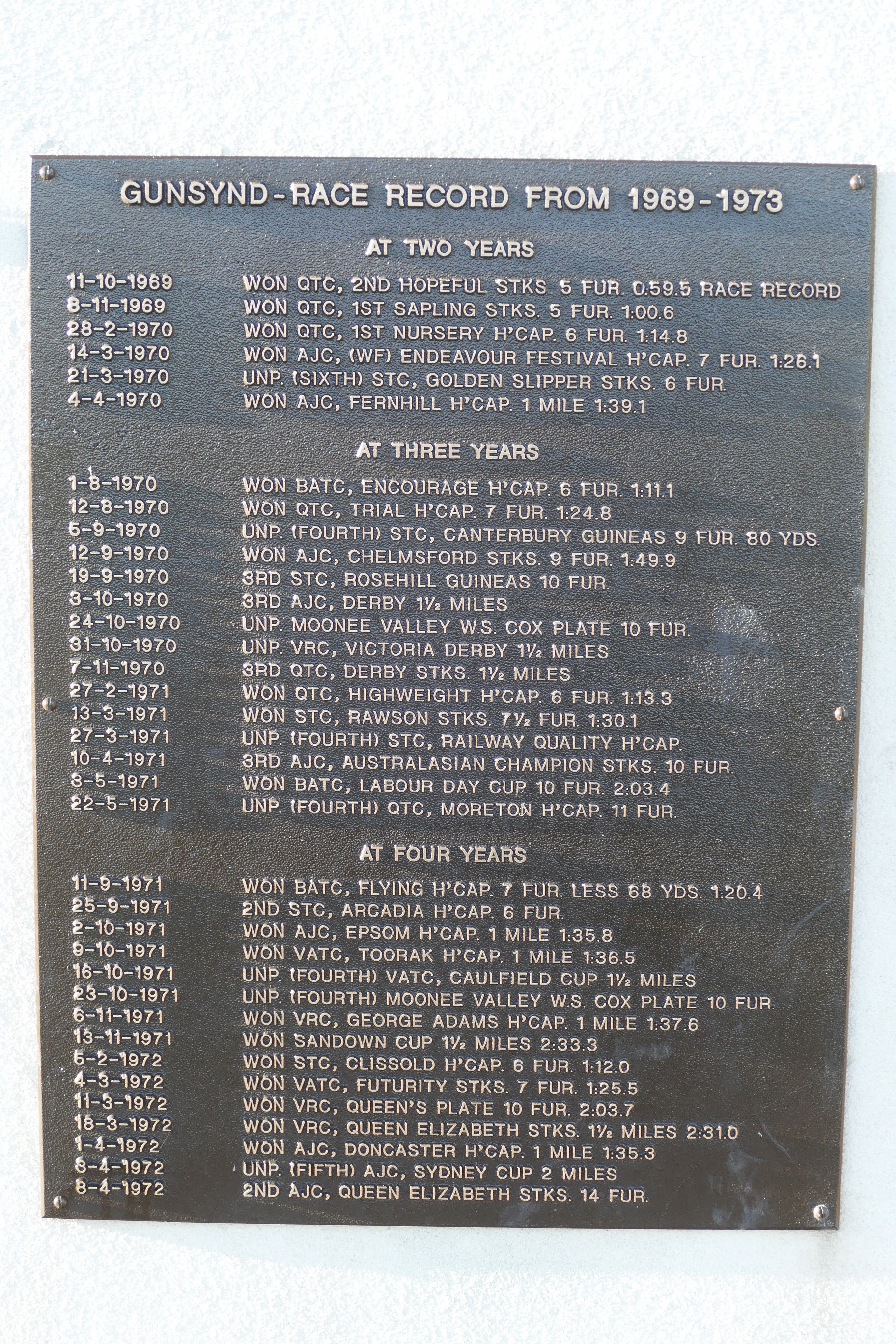
It turns out that the famous race horse,
Gunsynd came from Gundi.
The town seemed spotless and so well cared for.
Along the river is a great walkway where you'll find a memorial to the great horse.
This plaque lists the horse's successes.
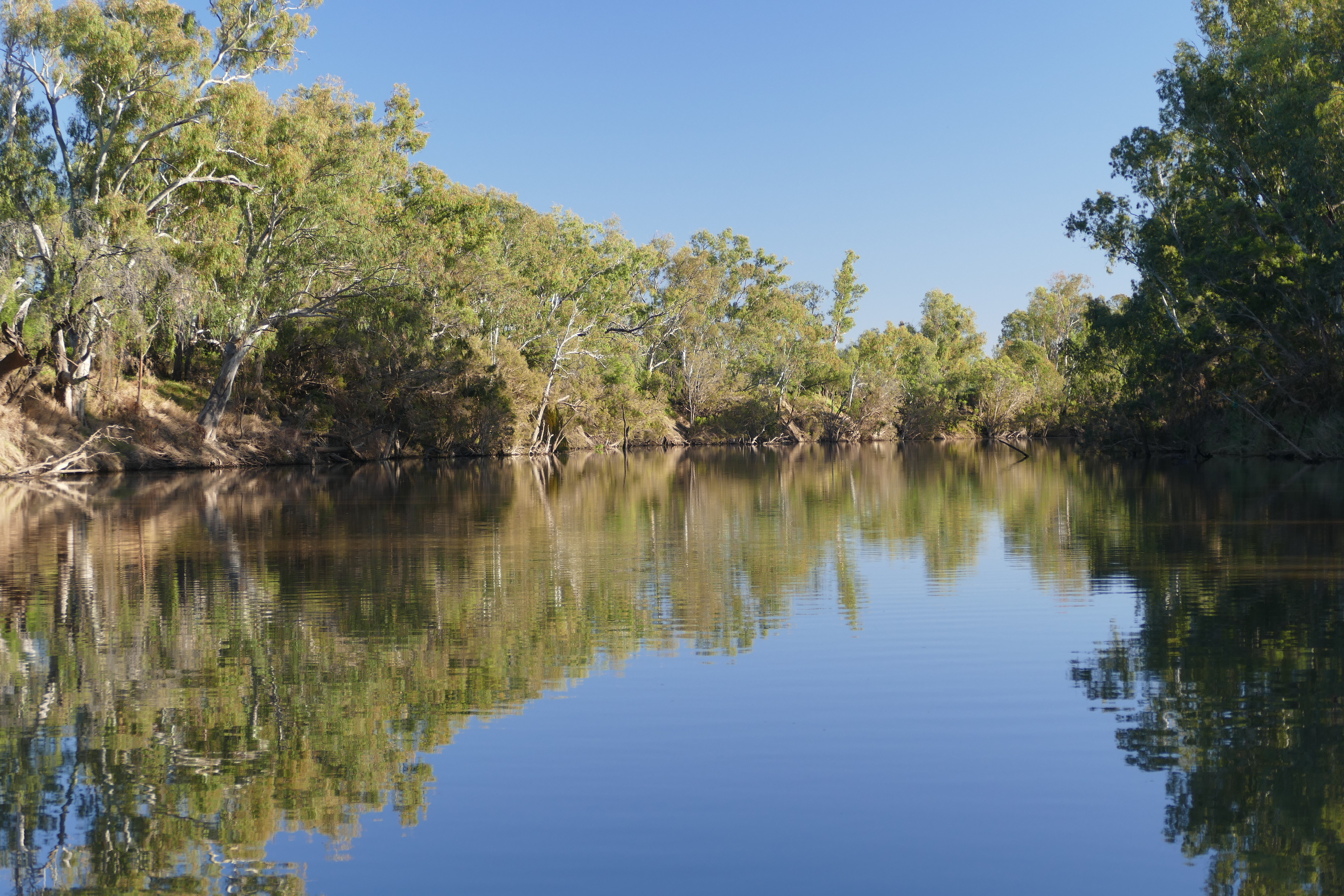
This bridge crossing the Macintyre River.
This angles shows just how tranquil the place is and you can also see the flood level indicator.
The tree of knowledge is where the locals would gather to view and discuss water levels in times of flooding.
Further along we find this huge work of art, made entirely of machine and engine parts.
Great imagination, I thought.
More of the same.
This indicator on the river bank shows the levee height in relation to past flooding levels, including one just recently.
Down at the boat ramp, we found this ingenious jetty that raises and lowers with the rise and fall of the river levels. I suppose they were tired of having to replace it after flooding.
Each of it's poles had rollers in the flooring holes that enabled the floor of the jetty to simply roll up and down as it needed.
Cathy enjoying her morning walk as usual.
The morning sun made for a perfect reflection off the surface of the water.
Soon it was time to leave, but not before taking this pick just on the southern side of the bridge, welcoming us back into NSW.
Looking back into Queensland.
An hour or so after leaving Goondiwindi, we pass this turn off where one of the residents obviously has an artistic streak.
I wouldn't mind one of these in my back yard.
One guess who the artist is.
This bloke!
Yet more of his work just across the road.
Our Tucson really impressed us on this trip, with it's comfort and incredible fuel economy.
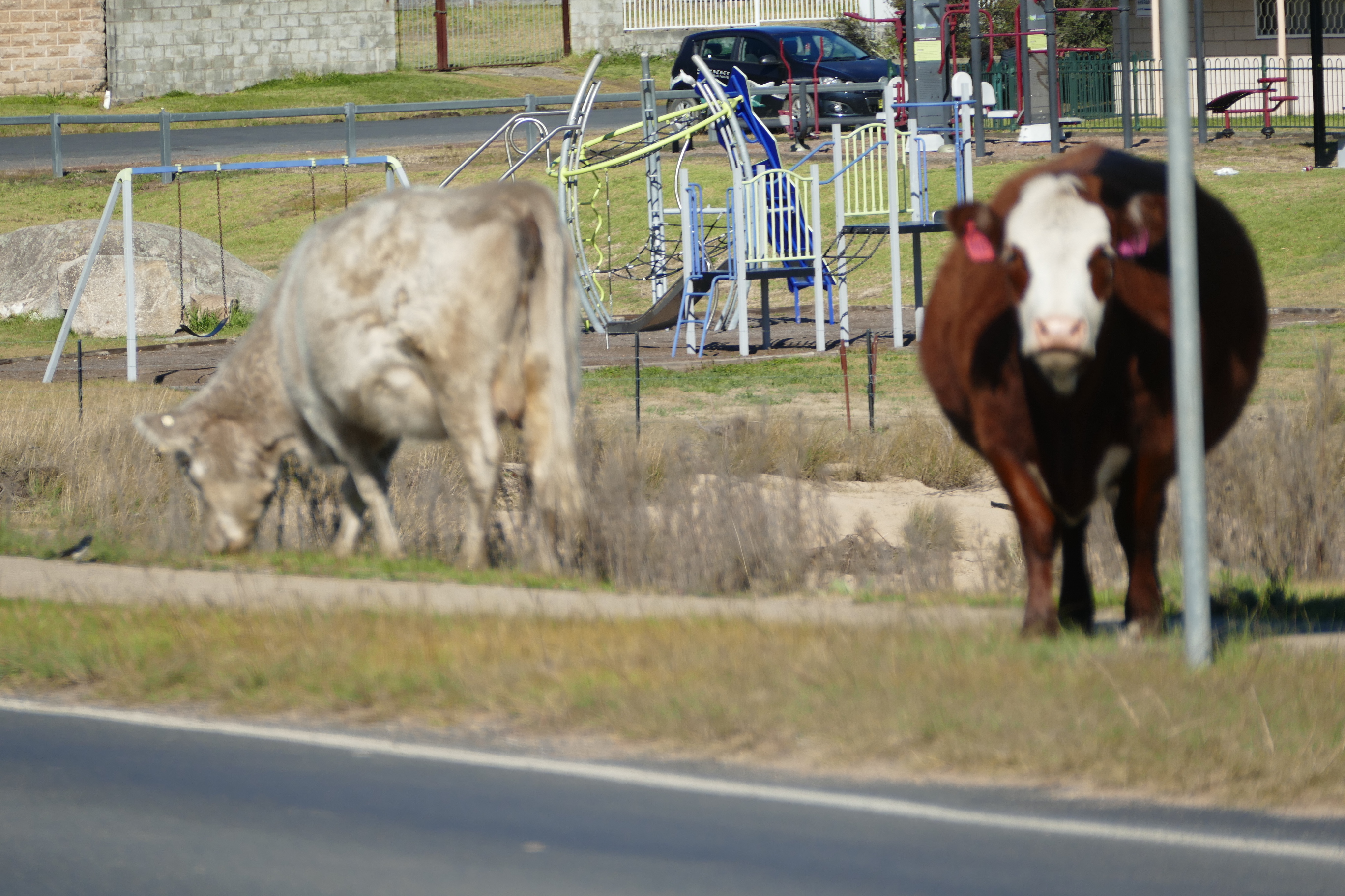
We stop briefly in the tiny town of
Tingha.
I love the casualness of life in these tiny towns.
Cows simply walking over the road, blocking a lane, but they do keep the grass down I suppose.
Once a tin mining town with a population of 8000, 2000 of Chinese heritage.
Unfortunately these days, there isn't much to appreciate in the town and it soon became apparent that there was a problem with the indigenous youth in the area. Such a far cry from Goondiwindi, where the population seemed to be so proud and content with their town.
The streets were bare and unwelcoming.
All the shops windows were barred up to avoid break ins.
The local pub still had a cool beer to offer although we passed as we didn't feel safe to hang around too long. Bloody shame.
We eventually made it to Guyra late in the afternoon where we decided to grab a bite to eat in the motel room and have a quiet evening.
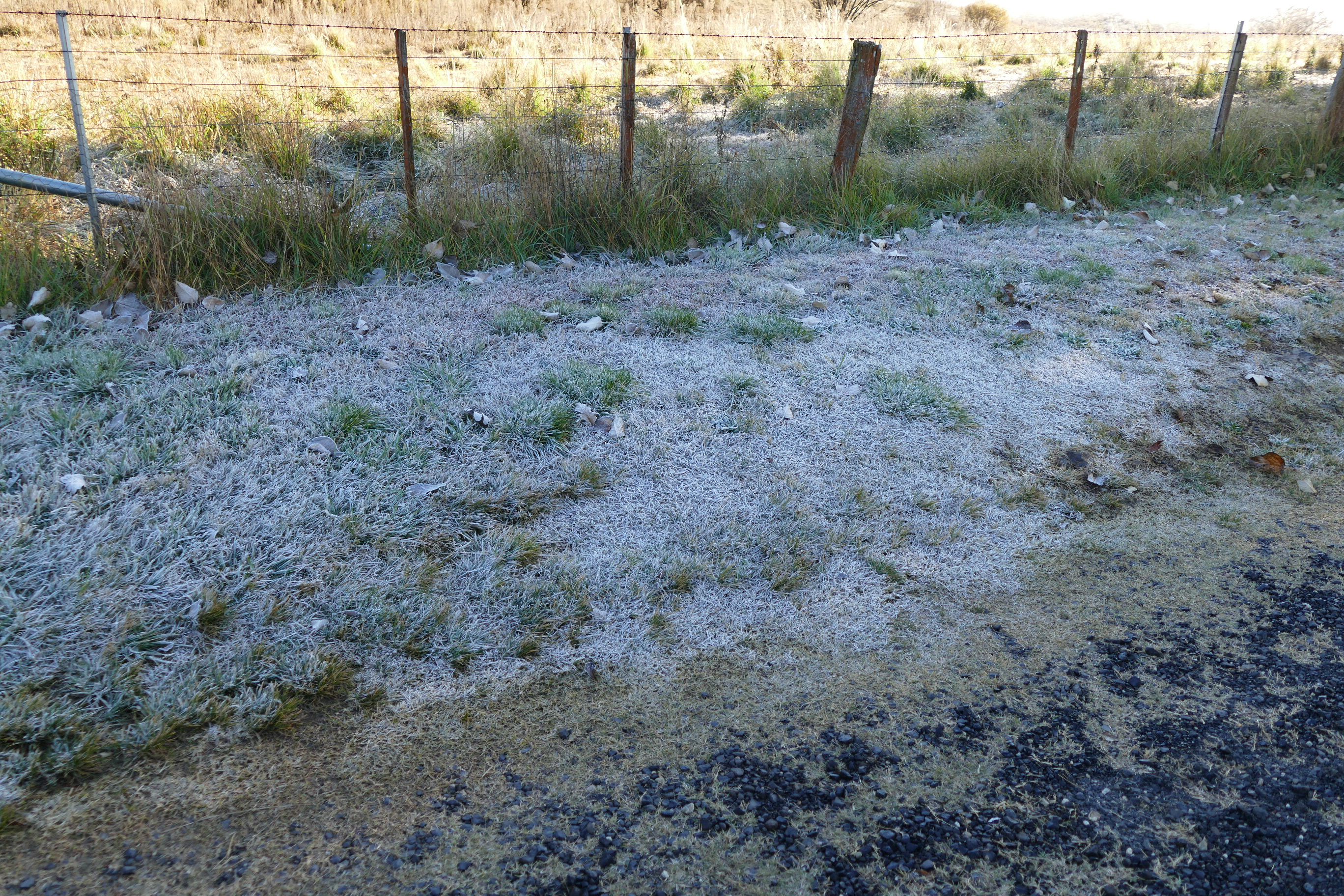
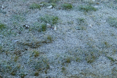
The next morning, we were met with frost all over the lawns and paddocks but we braved the cold for a quick walk around, although there wasn't much for us to see.

There was this monument in recognition of the efforts of Frank Presnell.
It seems old mate Frank left his mark on the town.
Not sure if this is a celebration of agriculture in the area or a huge cook off. Possibly both. 😝
Eventually we leave Guyra and make our way to the coast, via the Waterfall Way, Nambucca Heads to South West Rocks. One of our more scenic days.
Just out of Guyra, I just had to stop and capture the low lying fog nestled amongst the hills.
Soon the fog cleared to a perfect winter's day.
The falls were flowing well, due to the recent rain in the area.
These shots were all taken from the lookout above the falls, so we made our way down beside the top of them.
Gives you a different perspective.
The whole area was so green, given the amount of rain recently.
Just outside Dorrigo, is the National Park.
And it's Sky Walk.
The view over the mountains was spectacular on such a clear day.
As you can see, these falls are just along side the road and can close the Waterfall Way during periods of heavy rain when the falls gush across the road, making it dangerous to pass.
Hi Cath!
We've travelled this road quite a few times on our bike. Lots of fun.
Newell Falls, just a little further on.
Ordinarily, the falls pass under the road, as you can see.
This is Shelly Beach, just north of the Heads.
A beautiful part of the world.
Even the public toilets look good.
There's also a boat ramp. I thought it a bit odd, beaching the boat sideways, but each to his own.
A short drive back up the road, is a great lookout that takes in the view over the heads.
Wow, just wow!
Looking back up the inlet.
That caravan park must get packed during the holidays.
Definitely on our return to list.
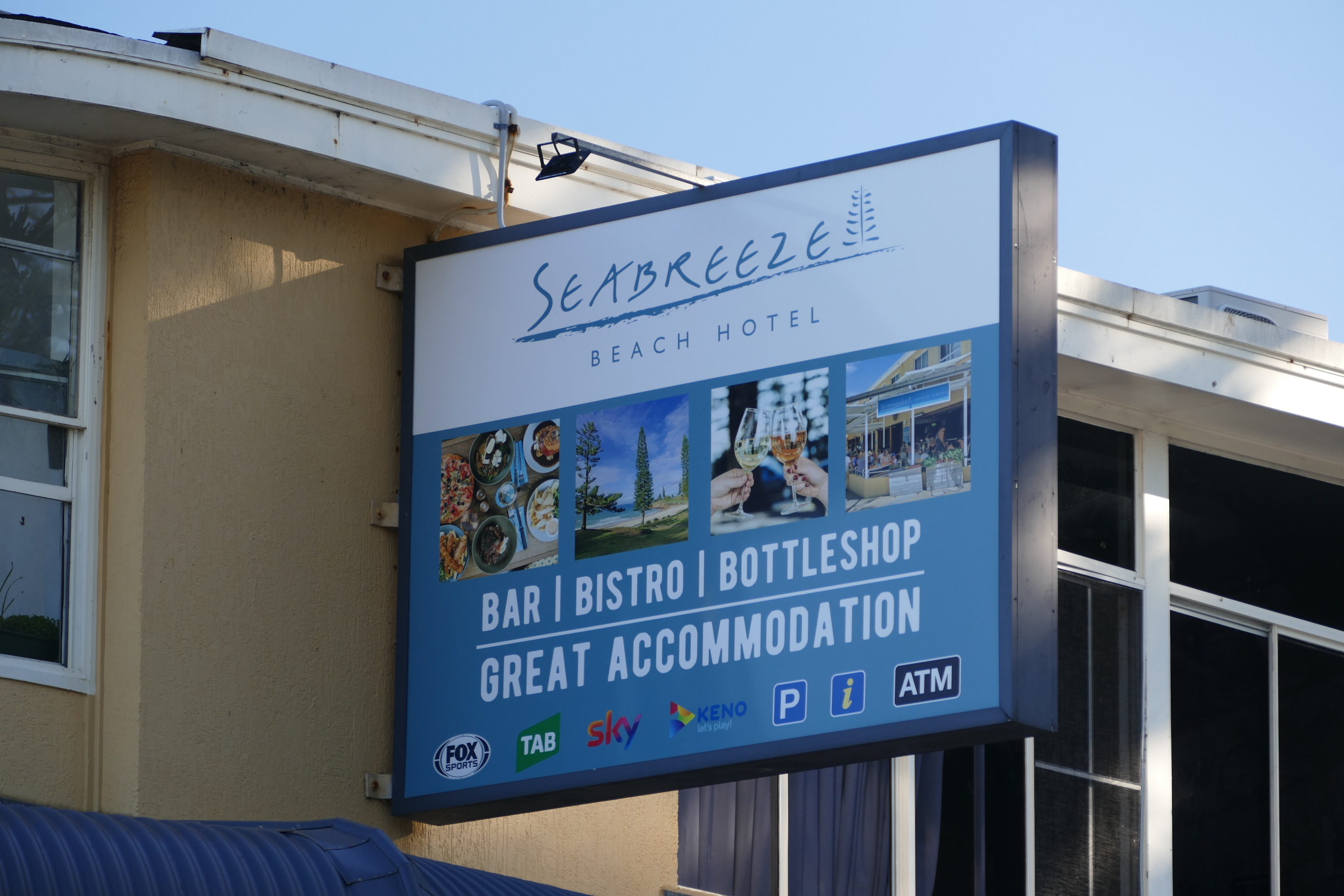
We arrive in South West Rocks late that afternoon and this modern pub, our bed for the night.
The
Seabreeze Hotel is recommended with it's motel style accommodation and great restaurant downstairs.
The next morning, we are in no rush to leave, as we have just a short trip down to Nelson Bay, so we take a walk to explore the place.
We've never been to
South West Rocks but we'll definitely be back. Remembering it's winter, but Cath and I were in t-shirts. The weather doesn't get better than this.
This walkway takes you along it's stunning coastline.
Horseshoe Bay, but no horses to be seen. 😆
The further we walked, the views kept coming.
The local Marine Rescue base.
Leaving South West Rocks, we make a stop in Port Macquarie. We've stayed here a few times on various bike trips but this time we took a look at the northern area of Port.
This area of Port Macquarie was much more tranquil away from the shops and hotels.
This fisherman was great to chat to and ended up being a friend of a friend back home in Mollymook. What a small world.
He had just caught a nice feed of flathead and the local pelicans were waiting for their share.
Arriving in Nelson Bay to visit and have tea with an old work mate.
Greeted with another perfect morning the next day, we take another walk from our hotel, before leaving for Rylstone in the upper Hunter Valley.
Taking a minute to appreciate the local wildlife.
Little Beach Boat House, just around the bend from the marina.
Nelson Bay Marina.
Leaving the coast, we made our way to the Bylong Valley Way in the upper Hunter, southeast of Mudgee.
Quite surprisingly, the paddocks were quite dry to everywhere else we'd been on our trip.
Bylong is a quiet little village all out on it's own.
This general store and the old church across the road, just about makes up the town, apart from the homes in surrounding properties.
Such a lovely old church sitting in the paddock on it's own.
The headstones are worth a read. They all belonged to members of just 3 or 4 families.
A couple of experimental black and whites.
The local magpie didn't seem to mind having his photo taken.
The last destination of our trip is
Rylstone, before heading to Sydney to spend time with close fiends.
The Globe Hotel was our accommodation for the night. A great place to stay in the Hunter Region.
A quick walk of the town before it got too cold. And it was ice cold in the evening.
I'm no art lover, but I do really appreciate old architecture and the work involved to achieve such a beautiful building.
There are quite a few old homes and shops in Rylstone that have been restored to their former beauty.
On a side street, I spot this old stable.
And it appeared to be in it's original state. Gotta love this.
Leaving Rylstone, we make our way to Sydney via Lithgow and the Bells Line of Road. Along the way we make a stop at Pearsons Lookout , looking out over
Capertee Valley.Our very own Capertee Valley is the widest Valley in the world with the Grand Canyon being the deepest.
Eventually we make it to Sydney to catch up with as many friends and family as possible, ending a great getaway with chatter, laughs and good times, but as always, it's such a relief to return home to beautiful, perfect Mollymook. Funnily enough, it's our love for travel that brought us here to start with, opening our minds to think outside the box and change our lives for the better.