This was a great trip and we saw and experienced alot however, as usual, we felt a little rushed because the best way to see our country, in my opinion is not to have a schedule at all, if you're able. But for the rest of us who have children and work to go back to, this will do for now.
We drove almost 4000 kms in all, including day trips to Ballarat and Avalon, which aren't included in the overall round trip shown on this (map).
Today's drive was probably the most uneventful of all the days because it's very straight forward and not much to see along the way at all. It didn't help that we'd done it all before a few times recently, however we did turn off to take a look at this little town on this occasion.


An old steam tractor they had on display in the park

They had a beautiful old pub just as every country town should.

This is what looked like an original home in the area, and I just had to take a pic of course.

Eventually, we made it to Wagga and discovered that they have a lame little zoo you can visit for free, so off we went as it was too early to go to our room at this stage.

Friendly little critter, I think he was as curious to see me as I was to see him.Differance was, he was the one behind the fence.......or was he ?

Here's his mate checking me out too.

They had this walk in aviary within the zoo as well.

He eats like I do, with food all over his face.

Here's a pic of old man emu just before he tried to take a piece out of my camera. After that, I just wanted to grab his head and give it a quick twist.

There was also a nice garden within the zoo. This is the chinese section.

After our breathtaking time at the Wagga zoo, we eventually made our way to the pub where we spent the night. Immediately we saw the beer and steak special and they won our hearts.

Here's my lovely wife unpacking the Mazda in to our room.

Today was the day with the biggest amount of kms to travel, especially taking in to account our diversion through Griffith to see a friend through work and also simply because we've never been before.
The picture below shows the typical type of road you travel along out there, complete with peak hour traffic.

I thought this scene made for a nice pic for no particular reason other than it had a nice wind mill.

After our visit to see my mate at the CHEP yard in Griffith, we went out to find Westend Wines, a family owned business with whom we've had a friendship with a member of the family who lives in Sydney.


So once we left Griffith, we started our way across the Hay Plain to Mildura. This is what you get for what seemed like hours.

Oh my God! A tree! We just had to pull over and take a pic, just in case you didn't believe us.

Oh goodie, only another 292 kms to go. By this time we were going mad !

Oh thank God, a town, oh and look another wind mill.

Finally, we made it to the border. Our first border crossing for the trip. By this time we were climbing the walls of the car going stir crazy.

This is the site of a new development in Mildura. When finished it will be quite fancy and upper class.

This is where we stayed in Mildura. Very clean and comfortable with a pool and no crowds.

There goes Cath again. She loved to go in and check out our accommodation to see whether to abuse me or commend me on my choice. This was another winner by the way.


This side of the pump house shows past flood levels. Looks like they had global warming back in 1956 too.

We spent two days in Mildura, purely to experience a trip down the Murray on an old paddle steamer.

So that's what we did. On this day we boarded the Rothbury. A grand old girl to be on board and experience.

So here's this old girl (the boat I mean) still chugging along 132 years after it was first built. Is it just me or is that bloody amazing?

Oh and they had a bar on board. I only had one though ..... promise.

Check out the size of the steering wheel. Old time power steering.

Here's a few more paddle boats moored on the shore.

The Murray river has several of these locks along it. In Mildura, it's Lock 11. They were built to aid the old steamers travelling along the Murray river but were never completed due to better roads and vehicles coming about and taking over, for more efficient transportation of goods etc.

Here it is beginning to pump the water out down to the level of the river on the other side.

Until finally it reaches the lower level and opens the gates to let us out.

A pic facing back toward the captain and showing the name clearly.

Day 4: Mildura to Adelaide (map)
This morning we left Mildura early and on the way out, I couldn't ignore this site in my rear vision mirror.

This is on the South Australian border. Here there is a truck checking point and they also stop small vehicles for fresh fruit. If you get caught with fruit there's a heavy fine.

Just over the border, is the town of Paringa which has its own Black Stump.The story goes that some ding bat found it and rode it down the river to his property just to show it off. I'm like WTF ? But why ?

Moving right along, we spotted a place selling fresh plums for just $2 a bag - bargain!

Diverting in to Blanchetown, we come across Lock 1 on the Murray.


A closer look.


An informative sign you might like to read.

Arriving into the Barossa region, we spot this olive shop.

I decide on the chilli olives - no surprises there.

Eventually we make it in to Port Adelaide and it's bloody raining just enough to be a pain in the arse. Lovely big wharf though and yes we walked it.

Here's the view back to the town.

Some nice old architecture as you can see.

And a real nice old light house.

This is where we stayed, pretty average and not much to do or see in the area other than the port and the Adelaide hills area.

This morning we leave Adelaide to travel the south coast of South Australia and on to Victoria's Great Ocean Road.
This is a view from the Adelaide Hills looking back to the City.

A zoom shot, you can just make out the harbour in the back ground.

The Adelaide Hills area has a distinct German / Austrian feel to it and we turn off to take a look at a cheese factory and German chocolate factory which are developed on an old dairy cooperative site.

A nice bit of vintage to share with some bikkies.

The chocolate factory next door. How convenient.

As you can see, Cath took off like a little girl in fantasyland. And yes, there were freebies to taste.

For about 200 kms along the South Australian coastline there are salt flats just like this. In some areas, the salt is piled almost a foot high.

Towns such as this are few and far between.

Typical coastline along this stretch.

Stopped to say hi to one of the locals. Nearly ran over him after the shot because he walked across our path when we started off..

This B&B / tavern / servo / bait supply is the town of Salt Creek. They have a sign on the door stating their opening hours but may close earlier, depending on how busy the highway is.Can't blame them suppose.

This was just up the road. Oil ? really ? Out here ?

The town of Kingston, just outside our destination of Robe.

Kingston's big lobster, but unfortunately we didn't get any. Alot of these little towns close early, unlike what we're used to back home.

Another nice jetty.

As you can tell by Cathy's hair, it got very windy out on the jetty.

Looking back at the town.

Have I mentioned my love of light houses, along with bridges and jettys ? I think it's my admiration for their resilience to the weather and ageing.

This sign below explains where this lighthouse stood before its relocation.

Nice shot of the beach, not a soul in sight.

Finally our destination, Robe South Australia.

Once again, the southern coast shows off its pristine beaches.

The rather modern lighthouse of Robe. Doesn't quite have the same charm of the old ones does it?

Robe has an ample fishing fleet just like most fishing towns. This is the dry dock where the vessels have maintenance done.

Notice this boat's name? Charming. I wonder if it reflects his confidence in his fishing ability?

Geeze, the old days were just too hard.

Here tis standing proudly as the day it was built.

Eventually, we make it to the holiday park where we were staying the night.

Another great little cabin.

Looking across the water front of Robe.

Day 6: Robe to Warrnambool (map)Today we continue along the southern coast, across the border once again into Victoria to Warnambool. The coastline from here on in just keeps on getting better and better.
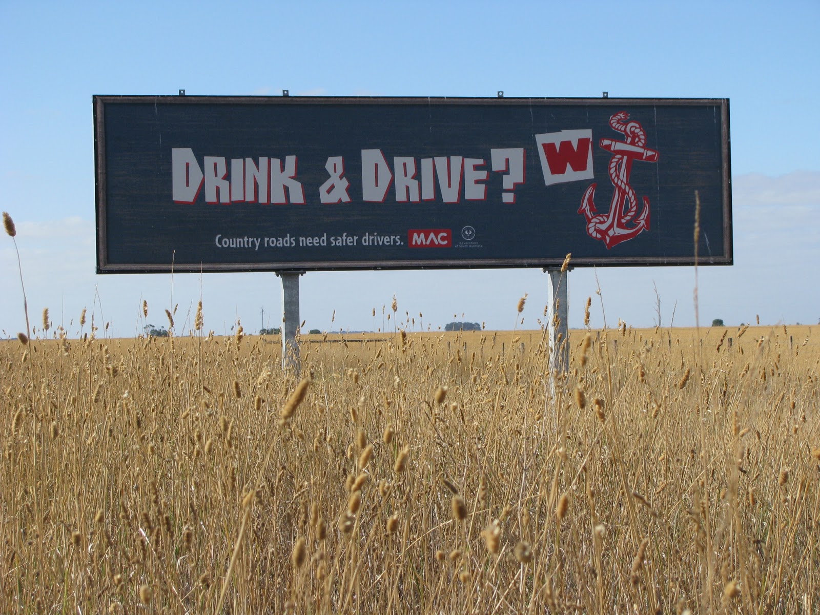
The country roads are dotted with these cheeky road safety signs - crude but effective. There was another two differant ones. One depicted a rooster (cock) and the other a door knob (knob).
A sign depicting the road ahead.

The town of Milicent.

This statue of a fire fighter was carved from a single tree trunk and is in memory of the Ash Wednesday fire fighters.

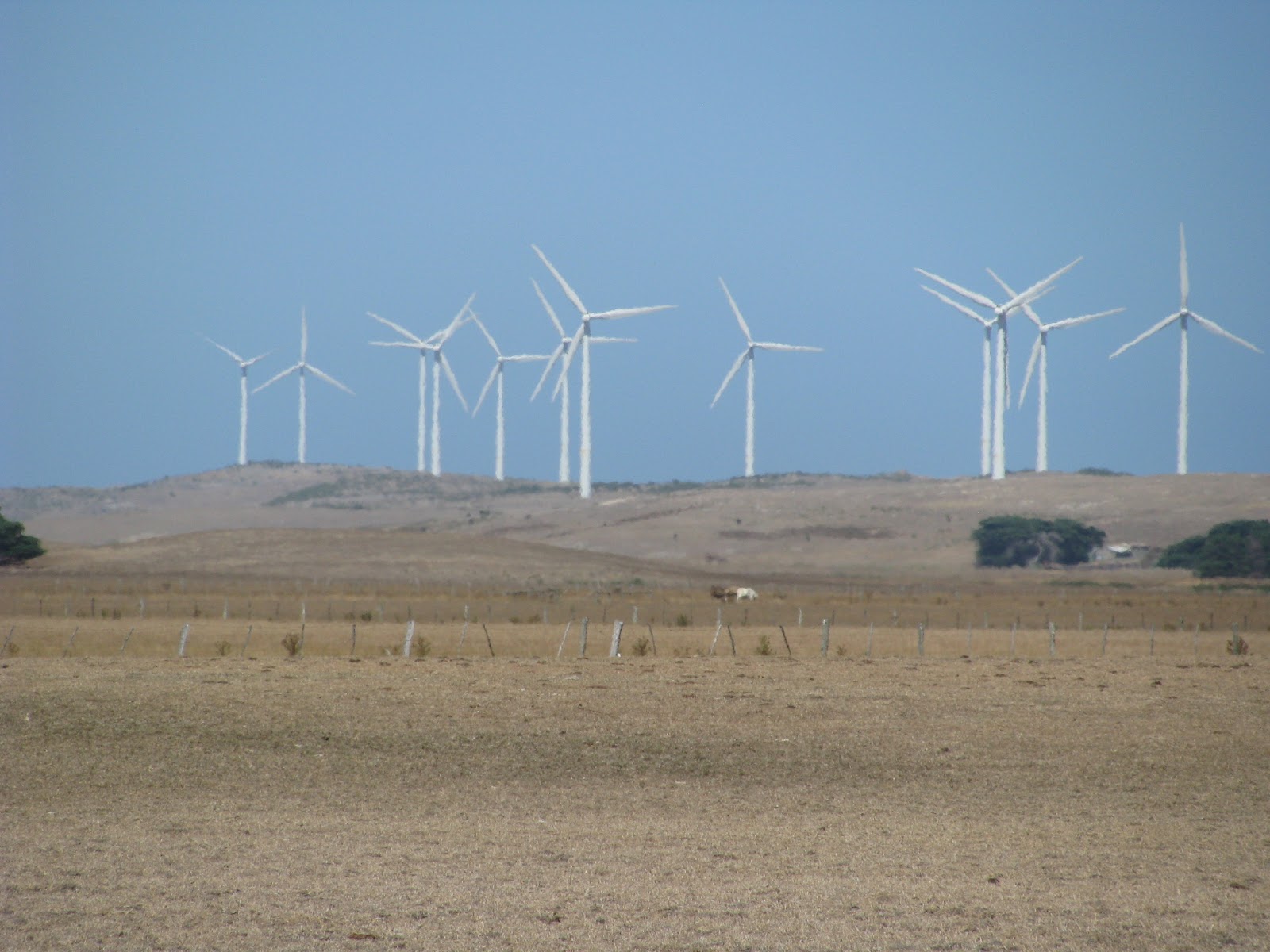
At first we didn't realise what this was. Well we can tell you it's a blade off one of those giant wind generators from a wind farm close by. Bloody huge!

The town of Mt Gambier, known for its lime stone quarries. Little Malta?

Mt Gambier's famous Blue Lake.

A sign explaining the lake.

Basically it's an extinct volcano. The beautiful blue coloured water is a result of the limestone at the bottom. Just like the water in the Mediterranean.

There's a 4.6 km walk which takes you right around the brim of the lake. Yes we walked it in about 40 minutes - bloody heroes we are!

This sign tells the story of the original lookout over the lake.

Here tis, just like it was all those years ago.

Of course we climbed it. Ya just gotta do these things.

The view from the old look out.

That's the pump house which still takes water from the lake.

On the other side of Mt Gambier, we found this strange but wonderful.

So the land collapses, forming this sink hole and the owner of the land decides to make a beautiful garden in it. One word - WOW. More info (here)

Looking up from the bottom.

Another great view of the garden within it.

One more showing the walk way carved in it. There's also a bbq area in there believe it or not.

One of the wind farms on the southern coast.

If you think back of that pic of the blade you saw earlier, you can imagine just how large these things are.
Our third border crossing of the trip, back in to Victoria.

First stop, the gorgeous Port Fairy

Oh yeah, I love taking pics of boats as well, just about anything seaside really.

This is looking up the river toward its mouth, you can see it's had all its banks reinforced

Off to the side is this island reserve. Well worth a look.

Saw this bloke sitting there "like a shag on a rock"

Oh my god, would you believe it? Even Pt Fairy has a lighthouse!


Here's the actual river mouth.

Here's a close up of Pt Fairy's lighthouse.

Here's an arty farty close up for you. These things are solid as a rock, actually, come to think of it. they are rocks.

This fella was just hopping around having a feed on the island. As the sign said previously, there's a large sheer water bird colony on the island. We couldn't see them because their nests are in burrows, but we could sure smell them.

This is the motor inn we stayed in at Warrnambool. Very nice and styled to keep in line with the history of the area.

Our room.Complete with air conditioning, kitchenette, lcd tv and comfy bed.

Warrnambool's harbour.

This large rock wall was built to provide calm for the harbour. The seas get so violent here that waves often come crashing over it and there are warning signs telling you this. See where the wall has been damaged by the waves?

This walkway takes you through Warrnambool's penguin colony. We didn't see any as it was day time but we could sure smell them as well.

View of the ocean from the board walk.

There goes Cath, charging ahead again.

Right along the south eastern coast of Australia and up the east coat, you'll get alot of whale sighting areas just like this.

The whales must put on quite a show here though because they've built this huge viewing platform to accommodate the sightseers.

Yep, another lighthouse. This little one has been relocated in the Warrnambool museum's property.


This area is at the rear of the museum and is called Flagstaff Hill. It's sort of like Sovereign Hill in Ballarat, where they do reinactments and shows. More info (here)

Today we leave Warrnambool and head across the Great Ocean Road to Melbourne.We then use Melbourne as our base to see the Air show and visit Ballarat. Two things on our to do list.

Now that's a bloody big cheese factory. Just across the road from where we refuelled the Mazda.

Ok ok, now we're getting excited.

All points of interest along here are well sign posted and worth a read.

The coastline along here is breathtaking and unspoilt as you can imagine.

Awww sweet. I'm very careful who I give my camera to, making sure they're old and can't run too fast.

Another angle of the Bay of Islands.

Then it was on to the Bay of Martyrs.

Sort of like the Bay of Islands but different.

Cathy trying her hand at photography.

Ah the Grotto.This was a little different and a nice walk.

Here tis.

I can't remember where this is exactly, but I think it's looking back from above the Grotto. Actually I could tell you anything and you'd believe me - it starts to all look the same.

London bridge. Very popular among the tourists.

"Oooh that looks nice", she's getting the hang of it now.

The archway. I have to tell you these sites are all kms apart and we just kept stopping and looking at all of them when we came across the signs.

Port Campbell is a nice little spot for a break and lunch.

Yep that's about all of it, but it has its own history as a port for the old steamers.

Ok I give up. I have no idea where this is but it's a nice pic so I included it for you to see.Actually, it may have been part of the razorback spot shown in the next pic.

The Razorback, named for obvious reasons.


This is what you see just left of the Razorback. Another great spot along the Great Ocean Road.
So by this time , I have to tell you, that we had seen alot of bloody rocks standing in the ocean. Yes it was very very good to see and experience, but truth be told, it was all looking the same by the time we got to the Twelve Apostles. When we approached them, we could see that there were millions, ok not millions but trillions of bloody tourists and their various vehicles already climbing all over the car park area. Well we have already done the twelve apostles a few years ago on a day trip from Melbourne so we decided to do it a little differently this time.
Well tourists in general are a lazy lot and on a time schedule so they weren't going to take the time to do these steps down to water level looking back at the twelve Apostles. But we did and well worth the effort.

Going down them was a sinch, however coming back up ........ well just a tad harder. Ah well that was today's exercise done and dusted.


This is what it's all about and changes the whole experience.

This is my favourite pic taken along the Great Ocean Road.The only thing you don't get is the fresh smell of the sea and the sound of the waves - perfect.

The water was so inviting and not so cold either.

Looking back toward the steps. See, not so many people can be bothered to go through the effort but they don't know what they're missing.

So here, we're finally approaching eastern end of the Great Ocean Road and in to the town of Apollo Bay.

The town of Apollo Bay, looking west. Nice spot as well.

Another lighthouse, just east of Apollo Bay. The road from here on in, is spectacular and runs right along the water's edge with the best views ever. Perfect motorcycle riding but not many places to stop because the road is narrow and built along the bottom of cliff edges like our own that goes through Stanwell Park and Coalcliff just before Wollongong.

Gotta love these old lighthouses.

This is the motor inn we stayed at in Essendon, Melbourne. Nothing flash, but clean and in a good spot handy to everything. It was an hour to Ballarat and an hour to Avalon Airport for the air show.

Our penthouse apartment, number 9.

After a great sleep, we headed off the next day to the Airshow These are held every 2 years at Avalon Airport in Melbourne and I'd been waiting for ages to see one of these.

One of our very fast planes, FA16 I think.

One of our manless aircraft controlled remotely - clever.

Here, you're looking at the control station for the manless plane above. It's all crammed into a 20ft shipping container and has a range of 250 kms, but that range can be extended with the help of satellites.

Mobile radar.

A big mumma carrier plane.


This is getting more exciting - the FA18 Hornet.


Cath and I were there on opening, but as you can see, it was filling fast.

Imagine seeing this big mongrel coming your way.

You could board some of the aircraft, and this was one of them. The lines were long but moved quickly. Overall the whole show was well organised in the same way.


Ever wondered what they looked like inside - huge with all the seating for the personnel you can see along the sides.

Coming out the back side - now I know what a chicken egg feels like.

The Americans brought some of their toys. They were very good for the show and put on an excellent aerial display. Actually without them, it would've been a little boring.

You can see why they're a dominating force. Their technology is way ahead.

The F22 Raptor. This thing is absolutely awesome to see in action. The sound goes right through you.

Another larger manless aircraft.

Up until 10am is when you get to look around at all the aircraft. After that they all come out to play and put on a real good show, so out came the fold up chairs and sun screen.

These guys were pretty special. Some of the moves they executed were incredible. You found yourself waiting for something bad to happen.

This American guy was incredibly talented. He built the plane himself and was described as the hot rod of aircraft. No amount of photos can do him justice. Here he was doing a verticle climb then held it stationery in the air like a helicopter.One of his most spectacular moves was when he flew across sideways in front of us with his nose in the air and only about 30 ft off the ground.

Alot larger in real life - you had to be there.

I think this was the F16 - very loud and quick also.

This was a rebuilt chopper that was used in the Vietnam war and now used for stunts, and yes, he's flying backward.

The F22 Raptor put on a great show - extremely loud and quick. at one stage it did a vertical climb right in front of us, 5000 meters straight up till we could no longer see it.

And here we have the Australian air force. No, actually it was in a small mobile museum at the show. All up we were at the show from 8:00 am in the morning till 3:30 pm.It was great to see and recommend you see it.

Today was earmarked to see the city of Ballarat and the Sovereign Hill complex where they have rebuilt a gold rush settlement as an educational and informative place on an area of land where the actual gold rush in Ballarat took place.
Nearby is Eureka where a battle took place to fight for the rights of the miners, while giving birth to democracy in Australia.

This statue stands as a memorial to the towns history, just outside Ballarat.

To be honest, we were a little sceptical paying our money to enter Sovereign Hill because we were expecting it to be a little lame, like some other places like this, we've seen. This place, however was very good. They went through a lot of effort and money to build it and the people playing the characters of the past were brilliant and had plenty of time to talk to visitors.

This husband and wife team spoke about life in the settlement along with all it's problems of health and racism toward the Chinese gold miners. The inside of their home was really interesting to see.

No cool rooms back then. We were told that the meat was hung like this for sale until they began to rot and or blown by flies. I think Ill pass, thanks all the same.

A typical miners hut.

A Chinese miner's hut - much neater. (take note Pat)

This cart was used to dump the rock away from the diggings.

We got to see a gold ingot get poured.


Yes it holds its heat well. Even after it solidified it was still hot enough to burn wood instantly. This ingot was real gold and worth about $160,000 from memory.

You can even pan for gold and yes they do find little flakes.

Looking down on to the town from a tower in the centre.


Lunch was at the bakery and freshly cooked on site.


Oh goodie, we're only 505 miles (800 kms) from Sydney
.


Another angle showing the wharf.


All the working machinery in sovereign hill was powered by two boilers like this one - very authentic and impressive.
A typical kitchen in one of the more "well to do" homes on top of the hill.

These are models of some of the larger ingots found in the area over the years.
Day 10: Melbourne to Lakes Entrance (map)
After a great couple of days in Melbourne, it was time to continue along the southern coast to Lakes Entrance. As you can see, the traffic getting out of Melbourne was ridiculous.
The village of Loch, our first stop for a break.
We parked in a picnic area where they had this memorial bridge.


This is the town of Loch in all its glory. On our various trips, it never ceases to amaze us of the places people live, I mean , what the hell do they do with their time? There seems to be nothing there but pleasant just the same.

Further on we come across this lookout over Corner Inlet.
And its 50 cent view point.

Oh goodie, we're only 505 miles (800 kms) from Sydney
.
Another great lookout over South Gippsland, we pulled into heaps of them because they good for a break and an opportunity to have a drink and a snack.

Great zoom shot that gives you an idea of how shallow these big lakes are.

Another opportunity to stretch our legs and go for a walk.

Not a bad spot but very dry. The bit of water that was there was full of perch.

We passed this place on the bridge you see in the background. We saw how nice it looked so we turned around for a closer look and another break.We did this a few times and felt that it was worth the effort because they really are hidden treasures.
Their moorings are very open and accessible.

This is what black swans look like just before they attack.

Apparently the light poles are also used as toilets by the locals.

We eventually make it to our destination for the day.

Yet another lookout, right outside our motel I might add.
And this is what you get at this place.
Another angle.
Yes they have their own fishing fleet as well..


This bridge takes you across to an island and the surf beach on the other side. Very pretty spot.
This is where we stayed in Lakes Entrance. Wouldn't recommend it.
As you can see it was overlooking the Entrance but the managers are letting it go a little.

So we're waiting for our dinner when I spot this sunset. I tell Cathy that I've just got to go get my camera from the car and I'd meet her in the park to eat our sea food. And off I run then back again to capture this beautiful shot. Aren't you glad I did?

Close up. The difference a few hours make. The colours in the evening are spectacular. Lakes entrance is definitely a place we will return to. I reckon we will do it on the bike with a stop in Bateman's Bay then on to Lakes entrance. On the way back will be through the Snowys so it will need to be a summer trip.
Day 11: Lakes Entrance to Eden (map)
Today we head on back over the New South Wales Border into Eden. Our very own south coast has the best coastline this country has to offer and seeing it all again has definitely helped us decide that this is where we eventually retire and live the simple life.
First stop, Sailor's Grave Beach near Marlo.

Not a sole in sight. Reminds me of a story that Irene and Phil told us about their trip around Australia where they found a deserted beach not far from here where Phillip decided to run around naked. (my apologies if you were eating while reading this)
We met and talked to a lovely couple that spent the night here in their motor home. They were from the Dandenongs and every March or April they leave for Darwin to spend the winter to return around October. They leave home with no set plans other than their destination. Other than that, they set up camp wherever they find themselves at the time and only using a holiday park when they get to Darwin. What a life style, I'm jealous.
Another nice walk at this place too. Stand straight Cath! Good girl.

Getting close to the border now.

Just in case you're wondering, this isn't just the local pub, this is a pic of the entire town. What the hell do people do with their time around here?

Apparently, opening these little bridges was a big deal back in the day.

They have closed the bridge for normal use and built a new one near it, but in the mean time, they've refurbished just enough to safely walk on, leaving the rest in its original state for all to see. - Great idea.

There's the newer bridge.

This is where we begin the trip back along the New South Wales south coast.

The old whaling town of Eden where we spend the night.

The entrance to Ben Boyd National Park. All dirt road but worth the trip and getting the car dirty, or in our case dirtier.
Ben Boyd tower. See how the top is damaged? Well apparently a strike of lightening did that.
Apparently, it was originally meant to be a lighthouse but it was never finished. In the meantime they used it to spot whales migrating past the coast.

A view out one of its windows.
The coastline in the area. Notice how red the rock is? This is due to its iron content.

Nearby is this old whaling station.
These are the original old homes, still standing overlooking the site.

The inlet where the whales were dragged in by boat then by large wooden winches.

Here's what's left of the old boilers and you can see a replica of a wooden winch in the background.
This is where we found yet another lookout in Eden. You can see Ben Boyd Tower in the distance across the bay.

And another good vantage point to see whales in the right time of year.

Eden harbour with its fishing fleet.

The Great Southern Hotel where we spent the night. Great Pub, great meals.

This is the view from our room that cost us just $70 for a night.

As usual with these old pubs, they have great verandahs with lots of character.
This museum is just a short stroll away. We've been there on a previous trip so gave it a miss this time.
Day 12: Eden to Mollymook (map)
Today we drive through the Sapphire Coast up to the Illawarra. The best coastline in Australia.
First stop, Merimbula.

Merimbula Harbour with a few of the locals just bumming around.
Here's a close up view showing some of the oyster beds that this area is known for.

Coming out of Merimbula, we come into Tathra. This is a historic wharf that is built in very deep water to serve the old steam ships. It was common to see sharks caught here but now it isn't allowed. Apparently sharks are dangerous.

Here's a great view looking back at the original sheds built on the wharf, now used as a cafe.
The wharf is a favourite place for locals to fish off.

Or for that matter, read the paper and have your coffee.

Heading into Bermagui, we find this beautiful beach.

Another great opportunity for a break.

Looking toward down town Bermagui.
Once again, a beautiful, clean harbour with crystal clear water.

The shags don't have to try too hard to catch their fish here. Notice how clear the water is?
It just so happened that a pod of dolphins swam by as we were talking to some other travelers.
The unmistakeable inlet of Narooma. For those who are interested, the famous fish and chip shop up high on the hill, doesn't exist any more. The sight now has some new apartments built on it. What a view they have.
Another angle showing the wharf.
We decided to head for Bateman's Bay for a lunch of fresh prawns with freshly squeezed lemon. By this time Cathy wasn't in the mood for another Captain Kodak moment, instead she just wanted to eat.
The locals were enjoying their lunch of prawn heads too. (sorry Pat)

I've photographed this bridge in Bateman's a few times now. One more time wont hurt.

Finally, we reach Ulladulla and it's beautiful little harbour.We love this part of the world.

So here is where we spent the last night of our holiday. The Aquarius Apartments Mollymook. It didn't cost us a cent. Ours is the first one on the left but we couldn't stay in it as planned because the people in it decided to extend their stay by 2 nights.... BUGGER! So we were given another room instead. (same but differant)

This is the view of the beach and golf club just 50 - 60 metres away.

View of the beach from the golf club, looking north.

Looking south.

Day 13: Mollymook back home.(map)
This trip was a great learning experience for future travels and we had a great time although a little rushed as I mentioned before.
For those interested here are some figures of the trip.
* We used almost 400 litres of fuel costing around $650 over almost 4000 kms over 2 weeks
* Accommodation came at a cost of $954 (not including Mollymook)
* Food, drink and entertainment totalled $1500
* Total cost for the trip was $3104 with an average of about $120 per person per day.
No comments:
Post a Comment